Saturday 16 May 2020

Day 61/6: Déconfinement - Jerusalem Sage

16 May 2020
Jerusalem Sage / Phlomis fruticosa ( shrubby )  is a species of plant in the sage family Lamiaceae, native to Albania, Cyprus, Greece, Italy, Turkey, and countries of the former Yugoslavia.]
Here is a specimen in my village.  I've never seen it in flower before or taken much notice of where it is! 
It is an evergreen shrub, up to 1 m tall by 1.5 m  wide. Sage-like, aromatic leaves are oval, 2-4 inches long, larger than  the common edible sage. i have read it is edible, but I think the leaves are not as tasty as common sage.  They are long, wrinkled, grey-green with white undersides, and covered with fine hairs. 
The flowers are deep yellow and tubular growing in whorls of 20 in short spikes in early summer.
It is popular as an ornamental plant. It gained gained a Royal Horticultural Society's Award of Garden Merit.   It has naturalised in parts of South West England..
It is listed as deer resistant, hard y and tolerant of a range of soil types.
Bees like it! 


Friday 15 May 2020

Day 60/5: Déconfinement - La Malvoisine - La Source Post 4 of 4

This post is rewritten. Somehow I managed to delete the previous report.

Day 2: 12 May 2020
Discovery of the Source of the Malvoisine.

The Paysage de Bocage is located btween two chemins opposite the lower woodland which it discharges into..
The water level is already lower as  the geological phenomena of the Source is not when gushing towards the Chateau.

We deviated from one by going through a hedgerow, which looked as if an animal or human had also cut through and arrived at a watery place at the edge of wheat fields.
No not here.... down there.....
Tricky to place our feet on rocks that move.
Insecure to told onto hedge treelings which are dead in places.
There in a hollow, at the base of a one metre high man made stone wall, against the embankment of the wheat fields. was the source bubbling up in one small place compared with the shallows in front of it.
Turn around and see the direction of the course into La Bocage.


Mission achieved. Time to depart.
We clambered to the wheat field and eventually came to  the other chemin.
I have fulfilled one of my ten year aims since living in the beautiful village.
Monday 11 May will be attributed to La Malvoisine from now on!


Thursday 14 May 2020

Day 59/4: Déconfinement - La Malvoisine Post 3 of 4

The disappearance of La Malvoisine 

It's almost as if it hasn't existed, apart from a few flattened grasses, shifted stones, rocks and soil. The chemin through the woodland was relatively damp to walk along and almost dry by about 11 in the morning- not many puddles to avoid.
The garden near the chateau has to rebuild the small containment wall.

flattened grasses


The culvert opposite the bocage.


Wednesday 13 May 2020

Day 58/3: Déconfinement - La Malvoisine Post 2 of 4

La Malvoisine in photos from La Bocage to Les Combes.
From the 'paysage du bocage'  the water exits the prairir under the road to woodland.


The stream emerges from the woodland at Les Combes

Then La Malvoisine disappears underground, under the road of the Centre d'Interpretation de le Roc aux Sorciers, before re-appearing in a channel in the garden of a house, progressing on its descent to the River.


Tuesday 12 May 2020

Day 56: Lockdown in France / Day 1 and 2 Déconfinement - La Malvoisine Post 1 of 4

Day 56: 11 May 2020
An end to Lockdown in France as we enter Day 1 Déconfinement and Partial Lockdown.

DAY 56: 11 May 2020: The Malvoisine decided to make comment.  Satisfied, she returned to bubbling & babbling at her source on Day 2: Déconfinement 12 May 2020.

Excitement was high yesterday, 11 May 2020, as I walked to the river late afternoon as the wind on the top road was too strong to walk against.  BUT, if I'd walked to the river at 9h I would have seen a greater flood.   
It's such a rare sight.  The last time was 1982.


Yesterday I spoke to several French villagers who in 20 years had never seen it and second home owners arriving from the local region into the village yesterday, knew nothing about its existence. 


Today, 12 May, I walked the course of La Malvoisine.  I was interested and curious to discover its source the day after the waters diminished as fast as it had grown!  I reasoned that today would be ideal to see if the bubbling from the ground could be found.  I was as excited as a small child to show my friend yesterday's photos and show her the route and what happened.   As teachers we had fun in our playtime of discovery learning.  I was glad she was willing to participate in the mad idea of searching for its source.  I needed courage.
1. 
To the left of the road passing the valley and La Malvoisine heading towards the chateau.
2.
The Malvoisine

I think the flood stream must be a kind neighbour as it shows when limestone water capacity is full.
This video describes the last flood of 1982:  https://anglessuranglin.com/la-malvoisine-en-1982/
12. 

Here is my translation with additions.

The route of the stream makes a pleasant dry walk through woodland at the base of a valley called 'Les Combes".   I love to walk through here on summer days with sunlight blinking through the leaves or when snow lies on the undergrowth and branches of the trees.
However, the fickle malvoisine shows up on rare occasions with impetuous floods that alternate with dry periods, hence the flow rate is variable.   Often, despite rainfall, the Malvoisine starts to recede, in that,  it stays quietly in its bed and bocage before ever reaching Les Combes - the valley before the cliffs.  It is a geographical phenomena.
It is an intermittent stream, which appears suddenly and severely without warning in a very small space of time, every 5 to 15 or so years.  The appearance of groundwater in flood mode may appear a little later than the strong rainfall that feeds it.. i.e. a day or two later.
The course of the groundwater is tortuous. It twists and winds to follow the fracture of the limestone massif and the inclination of the strata.
Initially, there is a progressive saturation of the cracks in the rock: this is the phase of concentration.
In a second phase, water invades the ducts.  This is the phase of climax that lasts until the rainfall feeding it ceases.   Then comes a slow decline which corresponds to the emptying of the major ducts.
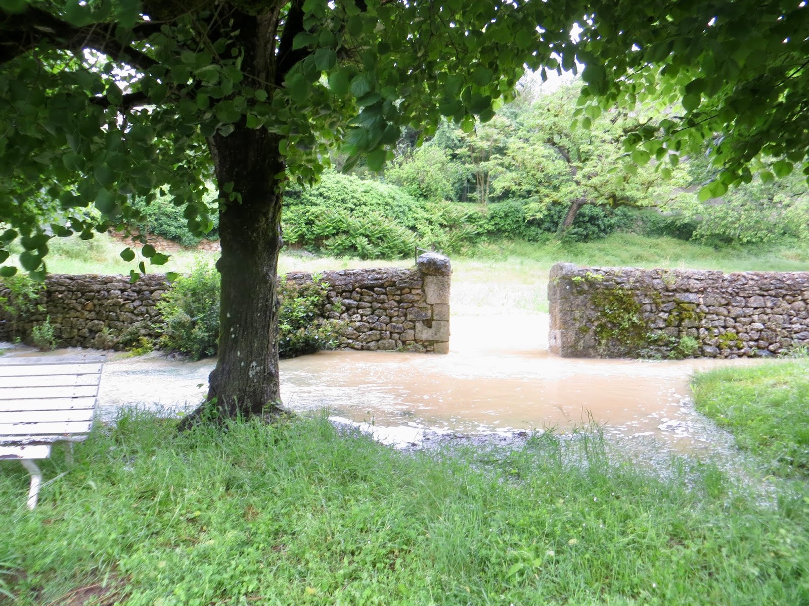
In heavy rain, often in spring, the water will rise from its source, marked by a stone wall in a bank against the wheat field within a natural copse.  It fills its bed, 'le lit', and flows into a flat meadow, 'un prairie,' which left fallow acts as 'un bocage' as a mixture of wooded land and pasture.  This smallish dry / wet field is contained at the side of the road, lower than the road, surrounded by hedgerows, trees and stone walls.  When the flood water escapes into the woodland (bocage) on more lower ground on the opposite side of the narrow road, it has had to pass through arch culverts, deliberately constructed and kept free of natural growth for this purpose.
The water leaves the spread of wooded area.  It is channelled on its descent along 'le chemin' which has one metre or more banks with dry stone walls.  Clearly these were man made to contain the direction of the water.  This chemin / footpath is known locally as 'La Malvoisine'.  It flows along its course along the road adjacent to the chateau, which eventually descends to the River Anglin at the bridge.
Look closely.  You can see the culvert, which carries the stream under the road from higher ground, ejecting into the river.


Part 1 - `A walk of discovery

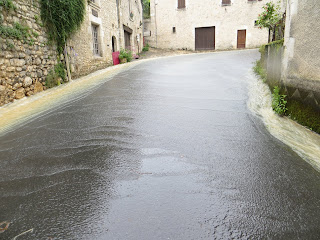
Above is the first view... when as I walked the S curve of the road descending to the river, but before meeting the chateau on my left,  I heard water and could not believe my eyes as I retraced my steps to see the empty channel which passes through a garden over full with La Malvoisine.   I raced home for the camera. 
3. Cross the road and look to the right
                                     
4.   5. Look back and the culvert beneath the bridge supporting the road is full.
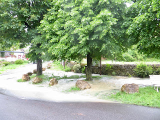
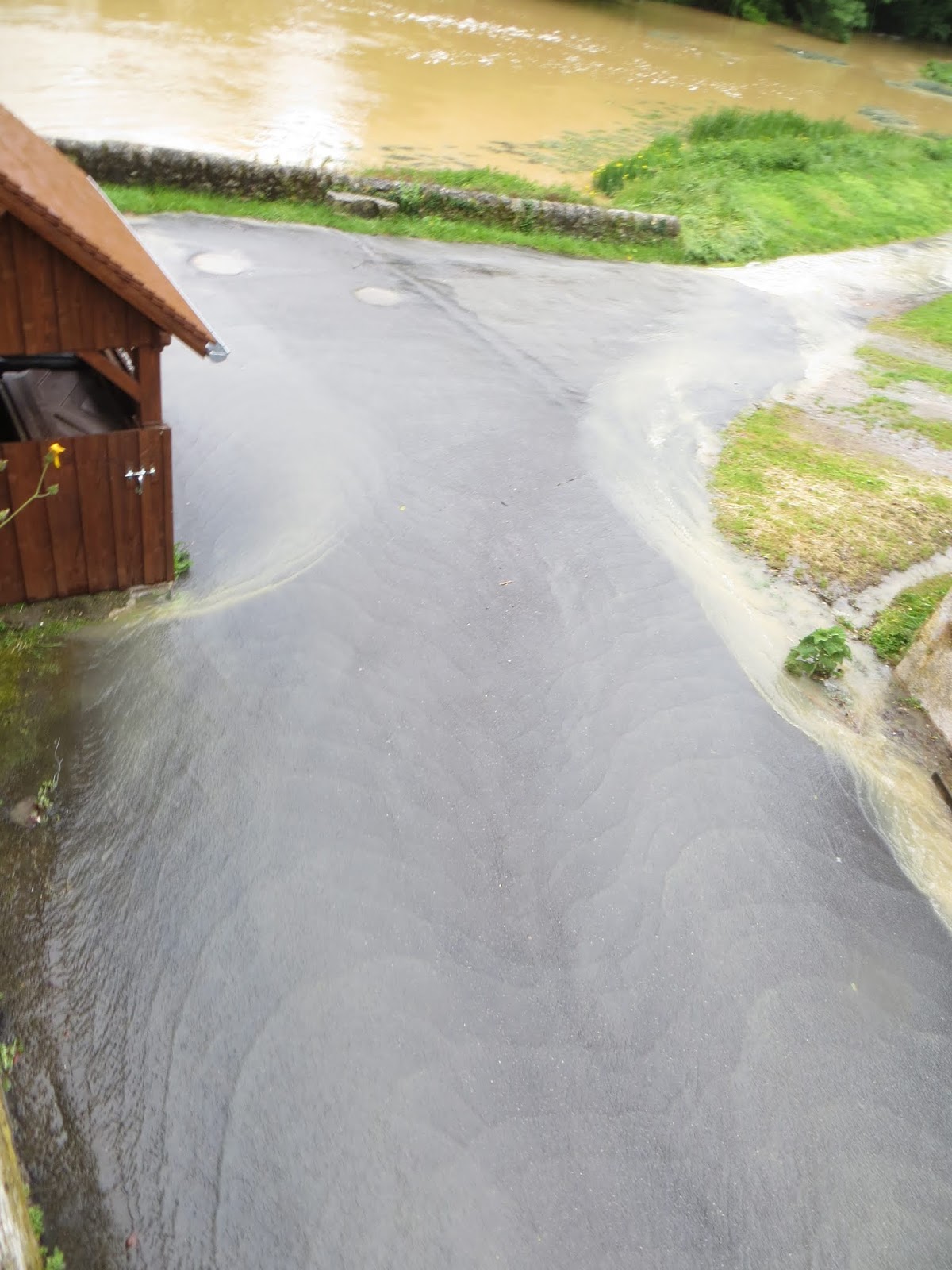
6.  The small picnic area is flooded inside and out.

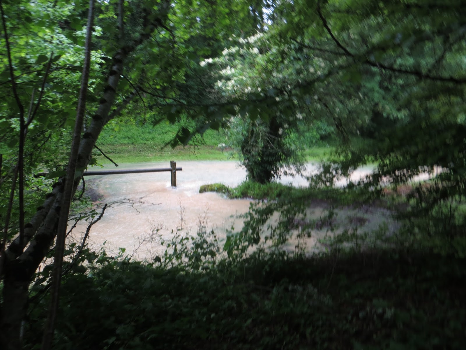
7.  8.  This is a reduced Malvoisine as it was at its height 6 or 7 hours earlier.
9. 

 10.
11.

12.

13.


14. 
Deflecting the water from entering the property


15. 16 On the bridge looking right and left

17. The Culvert discharging at force.

La Malvoisine ends its journey on the towpath before entering L'Anglin

 Tomorrow more photos of the Malvoisine from Le Bocage to Les Combes.

On Wednesday 13 May, late in the evening I received this VIDEO BONUS.  I am  grateful to my Tourist Office friend, the photographer and Le Mairie: 
https://www.youtube.com/watch?v=bzqkT8XXO_A