12.

Here is my translation with additions.
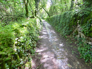
The route of the stream makes a pleasant dry walk through woodland at the base of a valley called 'Les Combes". I love to walk through here on summer days with sunlight blinking through the leaves or when snow lies on the undergrowth and branches of the trees.
However, the fickle malvoisine shows up on rare occasions with impetuous floods that alternate with dry periods, hence the flow rate is variable. Often, despite rainfall, the Malvoisine starts to recede, in that, it stays quietly in its bed and bocage before ever reaching Les Combes - the valley before the cliffs. It is a geographical phenomena.
It is an intermittent stream, which appears suddenly and severely without warning in a very small space of time, every 5 to 15 or so years. The appearance of groundwater in flood mode may appear a little later than the strong rainfall that feeds it.. i.e. a day or two later.
The course of the groundwater is tortuous. It twists and winds to follow the fracture of the limestone massif and the inclination of the strata.
Initially, there is a progressive saturation of the cracks in the rock: this is the phase of concentration.
In a second phase, water invades the ducts. This is the phase of climax that lasts until the rainfall feeding it ceases. Then comes a slow decline which corresponds to the emptying of the major ducts.
In heavy rain, often in spring, the water will rise from its source, marked by a stone wall in a bank against the wheat field within a natural copse. It fills its bed, 'le lit', and flows into a flat meadow, 'un prairie,' which left fallow acts as 'un bocage' as a mixture of wooded land and pasture. This smallish dry / wet field is contained at the side of the road, lower than the road, surrounded by hedgerows, trees and stone walls. When the flood water escapes into the woodland (bocage) on more lower ground on the opposite side of the narrow road, it has had to pass through arch culverts, deliberately constructed and kept free of natural growth for this purpose.
The water leaves the spread of wooded area. It is channelled on its descent along 'le chemin' which has one metre or more banks with dry stone walls. Clearly these were man made to contain the direction of the water. This chemin / footpath is known locally as 'La Malvoisine'. It flows along its course along the road adjacent to the chateau, which eventually descends to the River Anglin at the bridge.
Look closely. You can see the culvert, which carries the stream under the road from higher ground, ejecting into the river.
Part 1 - `A walk of discovery
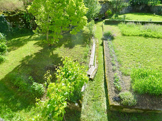
Above is the first view... when as I walked the S curve of the road descending to the river, but before meeting the chateau on my left, I heard water and could not believe my eyes as I retraced my steps to see the empty channel which passes through a garden over full with La Malvoisine. I raced home for the camera.
3. Cross the road and look to the right
 |
| 4. 5. Look back and the culvert beneath the bridge supporting the road is full. |
 |
| 6. The small picnic area is flooded inside and out. |

 |
| 7. 8. This is a reduced Malvoisine as it was at its height 6 or 7 hours earlier. |
9.

10.

11.

12.

13.

14.  |
| Deflecting the water from entering the property |
 |
| 15. 16 On the bridge looking right and left |
 |
| 17. The Culvert discharging at force. |
 |
| La Malvoisine ends its journey on the towpath before entering L'Anglin |
Tomorrow more photos of the Malvoisine from Le Bocage to Les Combes.
On Wednesday 13 May, late in the evening I received this VIDEO BONUS. I am grateful to my Tourist Office friend, the photographer and Le Mairie:
https://www.youtube.com/watch?v=bzqkT8XXO_A


 Turn around and see the direction of the course into La Bocage.


