Crossing the bridge at Angles sur L'Anglin we walked towards the Low Town Cemetery, climbed the cliff instead of going further along by the river (hopefully, we would return to that point from Le Remerle dam). My friend went ahead of me but I managed without stopping so was quite pleased. Onwards to the Roc a Midi and just beyond to the cliff edge* for a good view over the valley, then one has to retrace steps to avoid private land. Turn left at the road, see the large cabane to the right, continue to a modern cabane and continue straight ahead into La Vallée Sêche where it was verdantly green. Lots of treefalls across the winding path. Be alert to the changing atmosphere as one progresses and suddenly one is out into the open. Turn left and into Lassais. Turn right and right ( left takes one to St Pierre de Maillé) where a spectacular length of one metre logs are stacked, and we are heading back towards La Confluence. Eventually one has a choice to turn right but we head on towards the river where we discover the first crop of Purple Toothwort. Across "the passage de gués" when the water level is low enough it is possible to walk across and I have seen quad bikes cross, I see a favourite place of mine which I love to arrive at.
We find the track alongside the river to the dam and water is low enough to pass on the rocks and edge of the dam.
The trees have been cleared and one can see the house on the Route De Vicq,recently purchased and being renovated after years of emptiness. Further along some kind of dislodged drainage or water vent probably for the house high above?
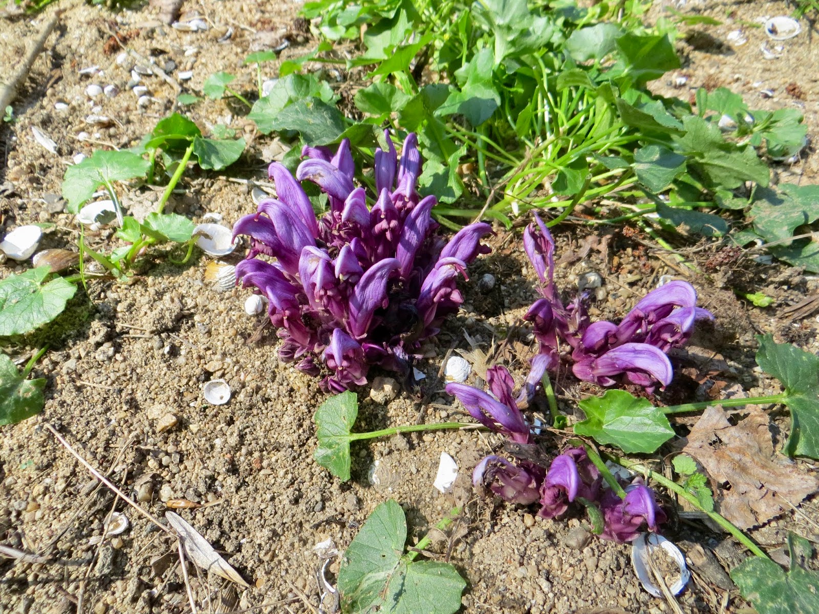
We continue at a better pace but are stopped again by brilliant arrays of Purple Toothwort. Kew Gardens describes it well.
http://powo.science.kew.org/taxon/urn:lsid:ipni.org:names:662042-1
We found rough steps up to above the caves in the cliffs (we didn't access those). I 'm sure I've never climbed or descended these before but up I scramble determined to not stop except for enough time to turn and take a photo. We were back to the furthest rock cliff (see above)*.
We descend to the river and return to the junction where we had started to climb the official randonnée footpath, then back towards the bridge, before which, 'a gilet jaune' was espied, face downwards off the beaten track, yet on
investigation there were no limbs or torso and not even the dog that it would have fitted.
Our walk ended... 4.5 km per hour of the 2 hours. Not speed walking but very enjoyable on a warm day. I still thought we had covered a lot of ground.
NOW:
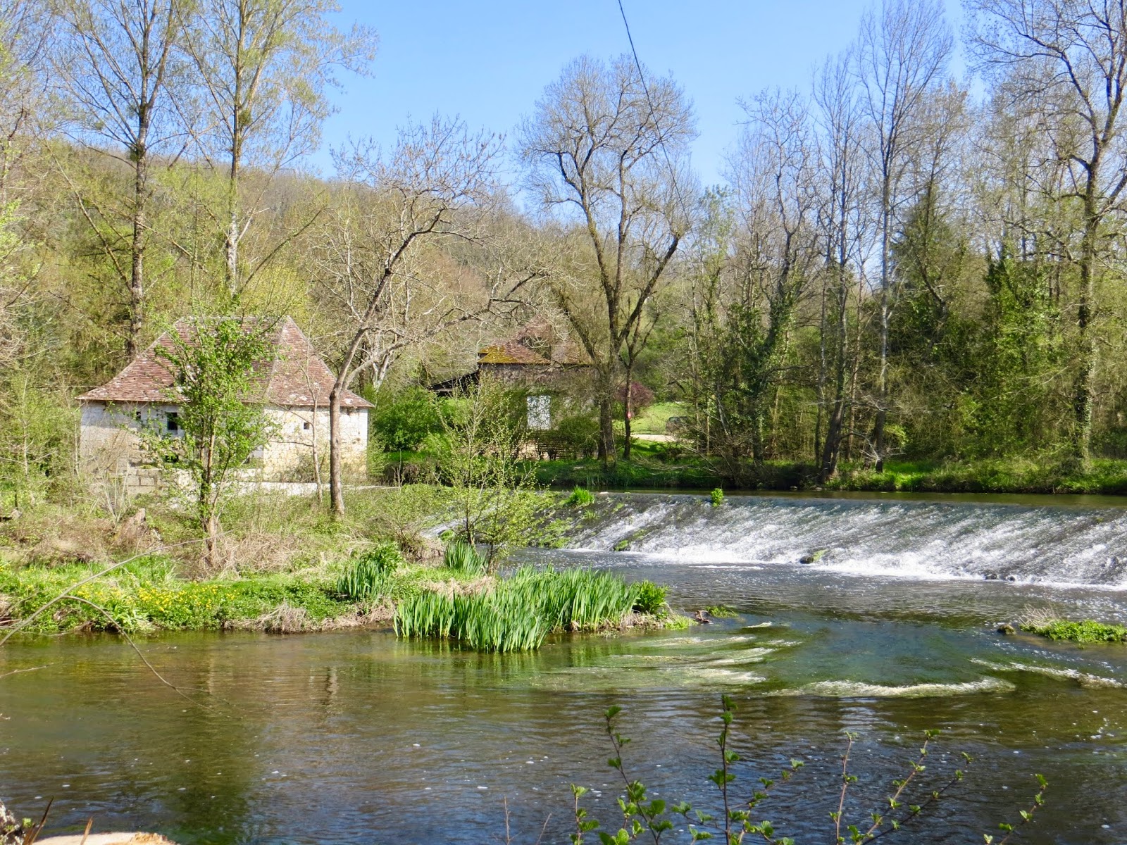
Here for me is a quintessential, visual image of Springtime in France.
and here,
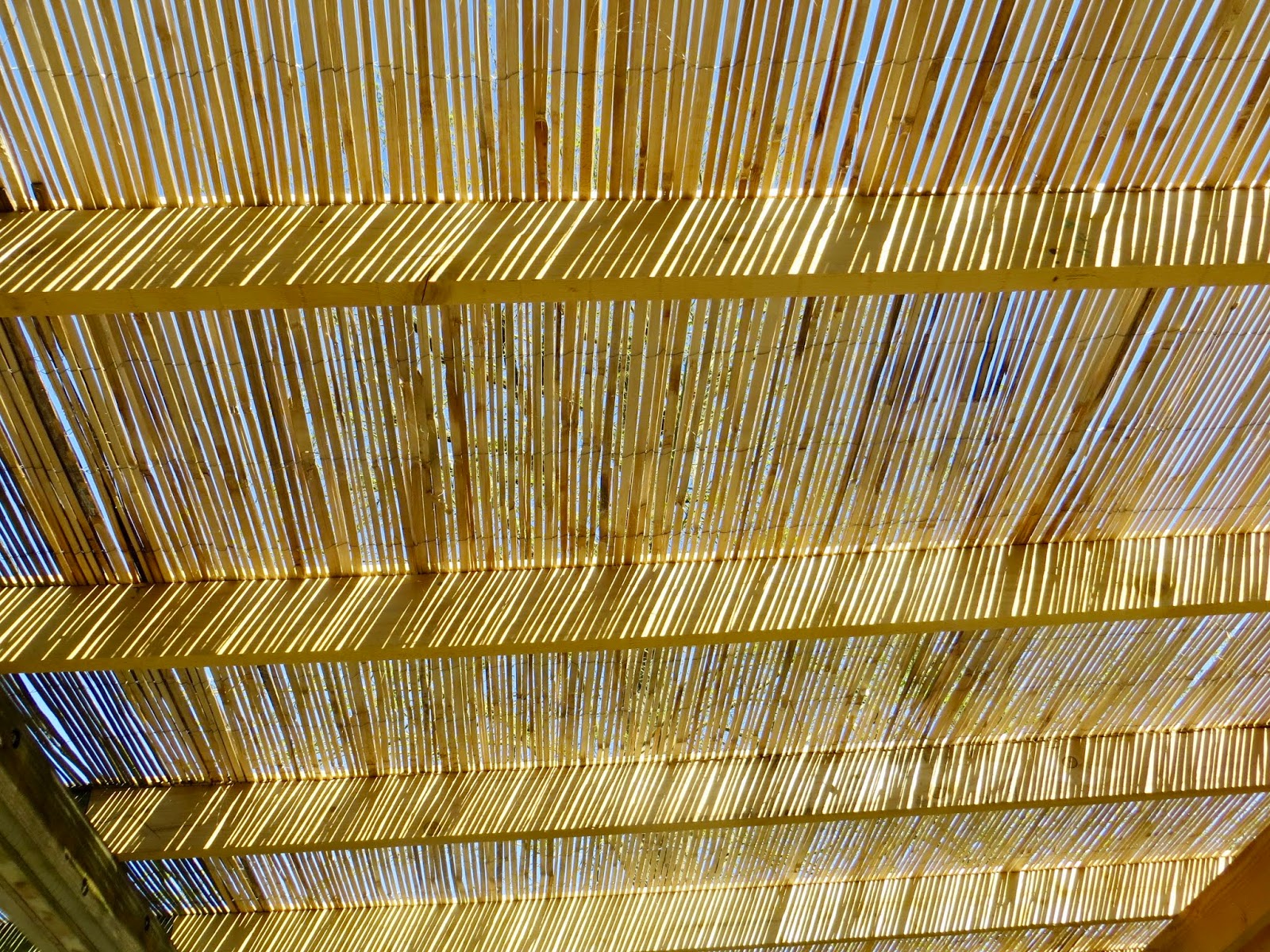
the newly replaced terrace shelter, whereat
No.15 English Tea Shop scones and cakes replace whatever calories one had lost!


No comments:
Post a Comment
It would be lovely to hear what you think.